Recent searches
Search options


1/ Next week (26th March  ) is the first ever Geomob Edinburgh, which is reason enough for us to turn this week's #geoweirdness focus to Scotland


Details of @geomob #geomobEDI
https://thegeomob.com/post/mar-26th-2024-geomobedi-details

2/ So first up Scotland is #geoweird in that it's not really clear what exactly it is. Is it a country? A region? A country within a country?
https://en.wikipedia.org/wiki/Countries_of_the_United_Kingdom
It's part of the UK  , but has its own legal system:
https://en.wikipedia.org/wiki/Scots_law
Some day we'll do a UK #geoweirdness thread, but be warned it will very, very long. No country (countries?) is/are as odd.

3/ Scotland and England  united in 1707.
The relationship between the "constituent countries" of the UK has evolved over time.
Fans of obscure political/geographic crossover references may recall the "West Lothian question" https://en.wikipedia.org/wiki/West_Lothian_question
in 1999 Scottish Parliament was (re)established. The popular Scottish National Party advocates for independence from the UK, and this culminated in the 2014 independence referendum, with "No" winning 55.3% to 44.7%
https://en.wikipedia.org/wiki/2014_Scottish_independence_referendum

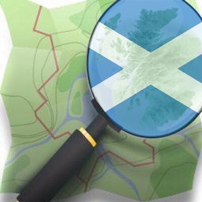
4/ You may not have recognised the map of Scotland in the toot that started this thread.
Traditionally many/most maps of Scotland or the entire UK have Shetland - the northernmost islands - in a box to save space.
In 2018 a law was introduced to ban "putting Shetland in a box", in an effort to combat "misconceptions about our islands"

5/ The Shetland boxing controversy lead to delightful "revenge maps" like this where the UK is boxed.
Perhaps fitting in that Shetland only joined Scotland in the 15th century. Before that the Northern Isles (Shetland and Orkney) were part of the Kingdom of Norway 

6/ Scotland fields its own national teams in most sports, but in the Olympics Scottish athletes compete as part of the UK team.
The national football team will open Euro 2024 versus hosts Germany  on June 14th.
Scotland has its own football leagues, which also include Berwick Rangers FC, a team based in Berwick-upon-Tweed which is just south of the border in England .


7/ Speaking of the border, many people mistakenly believe famous Hadrian's Wall to be the border between Scotland and England .
In fact it lies entirely in England, and was built by the Romans, well before Scotland and England existed
The actual border has moved many times over the centuries.
https://en.wikipedia.org/wiki/Debatable_Lands


8/ Heading north we have another bit of Scottish #geoweirdness - the island Lewis and Harris (Leòdhas agus na Hearadh in Scottish Gaelic), which, despite the dual name is a single island. 
https://en.wikipedia.org/wiki/Lewis_and_Harris
The Island is part of the Outer Hebrides, the area with the highest concentration of Scottish Gaelic speakers
https://en.wikipedia.org/wiki/Scottish_Gaelic


9/ Of course no mention of Scottish #geoweirdness would be complete without also mentioning that remote, uninhabited Rockall is - if you accept the British view - technically part of Scotland.
https://en.wikipedia.org/wiki/Rockall
Ireland  does not recognise the UK's territorial claim to Rockall.


10/ Scotland and the striking Scottish landscapes have inspired many, not least British explorers as they mapped the world. To the annoyance of geocoding systems like ours - Scottish place names are common around the world.
Today Nova Scotia (Latin for "New Scotland") is a province of Canada 
https://en.wikipedia.org/wiki/Nova_Scotia
New Caledonia  (Caledonia being the Latin name for the Highlands) is a French
  island territory in the Pacific near Vanuatu
  .
.
https://en.wikipedia.org/wiki/New_Caledonia


11/ In the 1690s, before unification with England , there was a short-lived effort to establish a Scottish colony - with the main settlement being named New Edinburgh - in what is today Panama  .
.
https://en.wikipedia.org/wiki/Darien_scheme
The settlement failed and 80% of the settlers died in the first year. The resulting financial weakness of the backers was one of the reasons for unification with England.


12/ Finally we of course need to mention the "Great Polish Map of Scotland", a 50x40 meter concrete terrain relief model of Scotland (excluding the Northern Isles) built in the 1970s by  Polish WWII veterans on the grounds of a hotel.
https://en.wikipedia.org/wiki/Great_Polish_Map_of_Scotland
And yes, of course the Great Polish Map of Scotland is itself well mapped in #OpenStreetMap
https://www.openstreetmap.org/?mlat=55.71199&mlon=-3.21642#map=19/55.71199/-3.21642


13/ That's it for our look at Scotland's #geoweirdness
Thanks for reading and boosting. What did we overlook?
We have more threads about specific countries, border disputes, geocoding, etc linked on our blog.
https://blog.opencagedata.com/geothreads
If you like Scotland (or dislike England) you may enjoy our thread about Ireland
https://en.osm.town/@opencage/111425788791484512
We hope you can make it to Geomob Edinburgh next week, hopefully the first of many to come. #geomobEDI
https://thegeomob.com/post/mar-26th-2024-geomobedi-details

Bonus toot: totally forgot to mention that the Scottish #OpenStreetMap community is also here in the fediverse - give them a follow: @osmalba
@opencage Thanks! We are looking forwared to GeoMob EDI tomorrow!