Recent searches
Search options

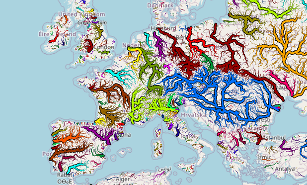
New WaterwayMap.org maps! Big Thick Rivers, in map form! The more upstreams a river has, the thicker the line on that map. It's the standard “Natural Waterways (downhills)” view, but *BETTER*.
explore it here: https://waterwaymap.org/#map=3.33/43.56/10.34&tiles=planet-grouped-ends
#OSM #OpenStreetMap #WaterwayMapOrg #gischat #waterway #hydrology #rivers

This is made 100% from OpenStreetMap data, for the whole world, updated daily, without any human intervention. This sort of data can be generated, today, from pure OpenStreetMap. 
This map is rendered client side, in your web browser. You can change the colours, or filter out small bits via the “Settings” button.
You can run this yourself, for an area you're
You need `cargo install` the `osm-lump-ways` tools ( src: <https://github.com/amandasaurus/osm-lump-ways>), and checkout the config files for WWM, you really just need the definition of flowing water: <https://github.com/amandasaurus/waterwaymap.org/blob/main/flowing_water.tagfilterfunc>. Then just `osm-lump-ways-down -i INPUT.osm.pbf -F @flowing_water.tagfilterfunc --flow-follows-tag name --grouped-ends ends.geojson --grouped-ends-max-distance-m 10e3`, and boom, you've got something you can open & style in QGis.
The rivers' colour is based on where they flow into. If you see a colour abruptly stop or change, it's probably that.
The upstream flow follows the OSM `name` tag when a waterway splits. If there's funny results, check how it's mapped (maybe there's something not connected?)

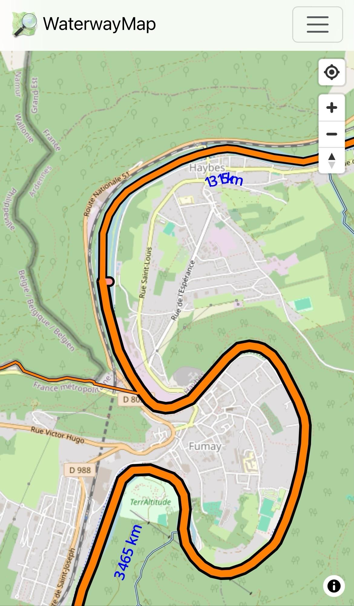
@grischard the little stubby peach bit? hmmm. It's a different colour because (I presume) there's an outward flow into the riverbank.
But hmmm, why is it so big? 
@grischard congrats on finding a bug. 
The issue is n8936587888, which is part of w242165569 (name=La Meuse), but across the river (west→east) goes w242395286 (name=Barrage de Vannes Alcorps). There are 2 in segments & 2 out segments (both w. name). Since that's more complicated than simple approaches, I just allocate the flow equally, hence half the Meuse going to the eastern end of that weir. 

 HackW/E@LinuxHotel @amapanda@en.osm.town
@grischard Now, the weir is tagged `waterway=dam;weir`. WWM excludes `=dam` & `=weir` but  …
…
So this is also a bug how WWM is configured, which should also be fixed.
@grischard I think I've fixed this bug, and this example looks fine now. If you see any more, let me know.

@amapanda @grischard just a little to the north the Meuse is losing a bit of size, just where it is joined by a channel: https://waterwaymap.org/#map=14.53/50.06521/4.71704&tiles=planet-grouped-ends . Weird!
Thanks for this map <3